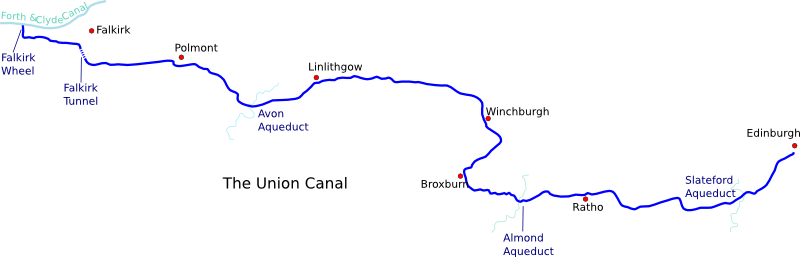
Map derived from data (c) OpenStreetMap
For detailed information on each section of the canal, click on the map
The Union Canal was built in 1822, primarily to transport coal into Edinburgh, but it was also used by many other industries and by passenger craft. In conjunction with the Forth and Clyde Canal, which it joins at Falkirk, it provides a canal link between Scotland's two main cities.
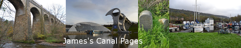
It was the last major canal to be built in Scotland, and its engineering works are quite railway-like in some ways. Apart from the interchange with the Forth and Clyde, it has no locks at all - it is on one level for 31 miles all the way from Falkirk to Edinburgh, mostly following the natural contours of the land, but in places making use of large cuttings and embankments to maintain its constant height. It is remarkable for its three major aqueducts, over the rivers Avon and Almond and the Water of Leith, considered by some to be the finest in Britain. It also included the only canal tunnel in Scotland when built (although following the recent restoration work at Falkirk, there are now two tunnels, both on the Union Canal).
The Union Canal was not a spectacular commercial success. Its useful life was relatively short, as the Edinburgh and Glasgow Railway opened in 1842, running mostly parallel to the canal and ultimately proving impossible for the boats to compete with. The terminal basins in Edinburgh were closed and filled in in 1922 and the lock flight to the Forth and Clyde went the same way in 1933, with commercial traffic on the canal ceasing completely a few years later.
The rest of the canal remained intact for another 30 years, but after it was officially closed in 1965 several parts of it were filled in and built over. Mostly this was for new road developments, most significantly the M8 motorway between Edinburgh and Glasgow, which severed the canal and towpath near Broxburn in 1970. At Wester Hailes on the outskirts of Edinburgh, over a mile of canal was obliterated to make way for a new housing scheme, the water being carried in underground pipes to the now-cut-off city section. There were plans to fill in even larger sections of the canal to make way for new roads. For a while the future looked bleak.
But even during its commercial heyday, the canal had been popular for leisure, and it was this use that ultimately saved it. In the mid-70s, only a few years after closure, boats returned to the water at Ratho and Linlithgow, then Edinburgh and Falkirk too. Canal enthusiasts campaigned successfully against the road developments that had threatened the canal, protecting it from further harm. From the 1990s onwards, the damage done after closure was gradually reversed - in 1992 the previously cut off section west of Linlithgow was re-opened, with the culverted road crossing at Preston Road replaced by a new bridge and the collapsed embankment at Kettlestoun finally repaired.
In the late 90s the canal's owners, British Waterways, successfully bid to the National Lottery Millennium Fund for money to completely restore both the Union and Forth and Clyde canals. After a few years of frenzied restoration work, the canal was triumphantly re-opened in Spring 2002, boasting numerous rebuilt road bridges, a brand new section of canal through Wester Hailes, and the world's first ever rotating boat lift reconnecting the broken link to the Forth and Clyde Canal at Falkirk.