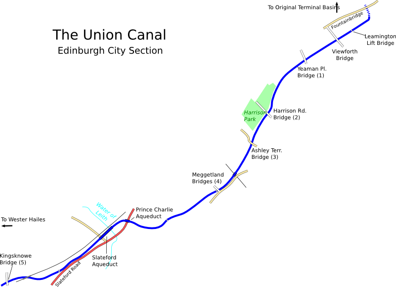
Map derived from data (c) OpenStreetMap
Today the Union Canal begins behind Cargo, a trendy bar and restaurant on Fountainbridge. It used to go further into the city; the original terminus was a basin called Port Hopetoun next to Lothian Road, but all that's left there now is a plaque on the wall of Lothian House commemorating the canal. The new terminus is called the Lochrin Basin. For a long time it lay forgotten and surrounded by run-down old buildings, but following the canal's reopening it has been much improved and is now usually full of colourful boats.
Just around the corner from Cargo, the first bridge is the canal's only lifting bridge, the Leamington Lift Bridge. This originally carried Fountainbridge across the canal but was moved to its current location in 1922 when the terminal basins were closed. When the canal was closed, the bridge was fixed in its closed position, cutting off Lochrin Basin from the rest of the city section. The original plan for the reopened canal had this bridge fixed in its open position, but thanks to some extra money from the local council, it was restored to full working order instead.
The canal heads westwards towards Viewforth Bridge. There was previously a brewery on the north side here but it is now closed. Viewforth Bridge is a stone arch like most of the Union Canal's bridges, but it is more decorative than most - it has a castle carved into its eastern keystone to represent Edinburgh, and a tree on the other side for Glasgow. (Confusingly, these first two bridges were not included in the original numbering, which starts at the next bridge, Yeaman Place [1], and runs to Bantaskin Bridge in Falkirk [62]).
For the first mile or so, tenements rise on either side of the canal, but the view opens out at Harrison Park, a pleasant green space on the north bank. There is an impressive church just to the south of Harrison Road Bridge, and Edinburgh Canal Society's pretty boathouse by the next bridge at Ashley Terrace. From here on the tenements are replaced by larger suburban houses. The Edinburgh South Suburban railway line passes under the canal next to another boathouse, and the only surviving original numbered bridge (4) within the city stands next to the Meggetland Playing Fields. It's now disused and bypassed by a newer concrete bridge.
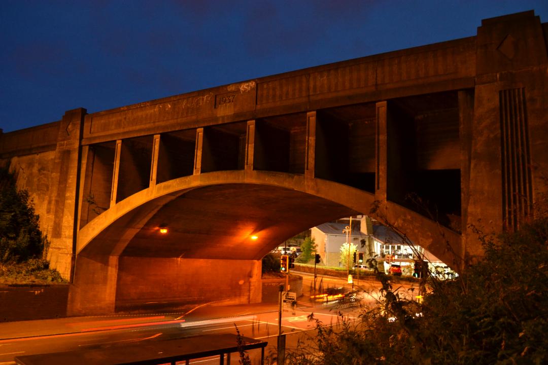
Prince Charlie Aqueduct by night
At Slateford, the canal is on an embankment above the surrounding streets, and it crosses over two aqueducts - first is a large 1937-built concrete arch over Slateford Road, known as the Prince Charlie Aqueduct as it is close to where Bonnie Prince Charlie set up his headquarters in 1745. The other is the first of the canal's major aqueducts, the Slateford Aqueduct, which crosses the valley of the Water of Leith. It consists of 8 stone arches, and with a total length of 500ft, it's the second longest aqueduct in Scotland. The steps here join up with the Water of Leith Walkway, and there is a visitor centre just below as well. A building supply yard nestles between the aqueduct and a parallel railway viaduct, and at the other end Inglis Green Road also passes underneath.
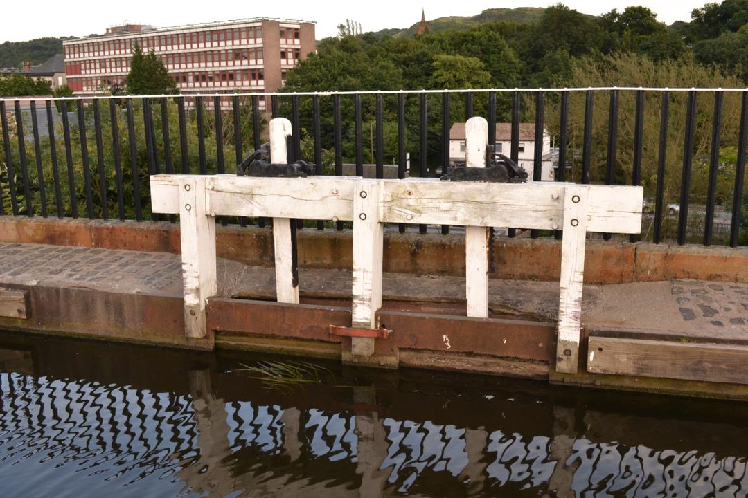
Sluice gate on Slateford Aqueduct
Two railway bridges, one now a cycle path and one still a working main line, pass overhead as the canal wends its green way towards the outer suburbs. The road bridge next to Kingsknowe Station is the first of many built for the canal's restoration, all in the same "Millennium Link" style - concrete, but with an arch and keystone effect remeniscent of the canal's original bridges cast into the deck, including the original number (in this case 5). Previously the water was piped through an embankment here. Beyond the bridge, the open grassy space of Hailes Park is on the north side as we approach what was one of the largest challenges to the canal's restoration: Wester Hailes.