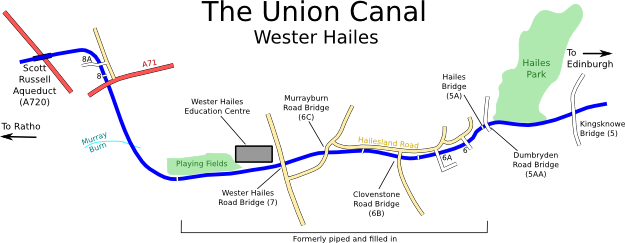
Map derived from data (c) OpenStreetMap
Over a mile of the canal, from Dumbryden Road to Calder Crescent, was filled in and piped through Wester Hailes in the late 1960s, mostly due to concerns about child safety (a section of the Murray Burn in the area was also culverted). This caused major headaches when it came to restoring navigation, however it wasn't as bad as it might have seemed because the route of the canal was mostly underneath roads and green spaces. The only building actually on the line of the canal was a new internet cafe, which had been granted planning permission on the understanding that it would have to be demolished if the canal was ever to be reopened.
Work to re-instate the missing mile began in late 1999 and took almost two years. The most time-consuming and costly part was the bridges; six brand new road bridges, one of which (Wester Hailes Road) was a dual carriageway, and two new foot bridges had to be built to maintain access across the new canal. There was also a surprise in store for local residents. The original stone arched Hailes Bridge, which had been buried inside the Dumbryden Road embankment and (apart from the parapet wall) completely hidden from view during the years of closure, was dug out, patched up, and brought back into use as a footbridge! Nowhere on the canal has the original bridge numbering system been so stretched as in Wester Hailes: within a mile there is 5AA (Dumbryden Road), 5A (Hailes Bridge), 6 (Dumbryden Grove), 6A (Hailesland Park), 6B (Clovenstone Road), 6C (Murrayburn Road), 7 (Wester Hailes Road), and that's without even numbering most of the footbridges. In comparison to the bridges, excavating the actual canal channel and lining it with special modern waterproof liners was fairly trivial.
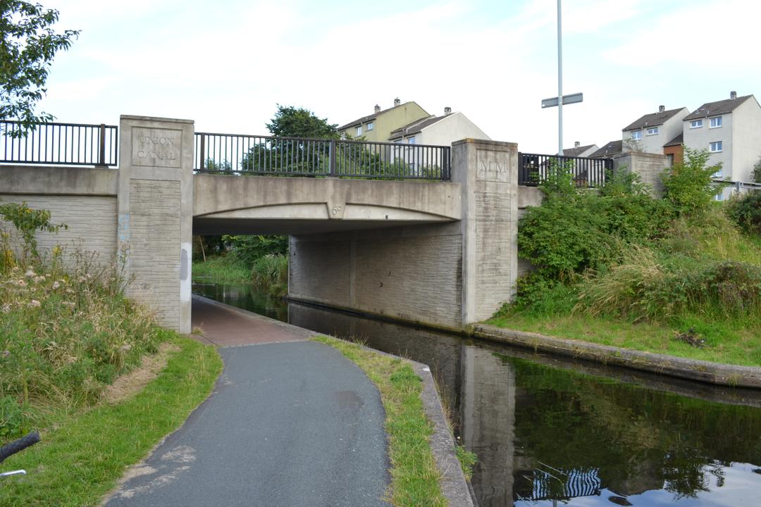
One of the new Millennium bridges at Wester Hailes
The new canal was declared open in August 2001 when a flotilla of boats sailed from Kingsknowe to Calder Crescent, celebrating the reunion of the city section with the rural canal to the west.
After passing the Wester Hailes Education Centre and its playing fields on the right, the former infilled section ends at the footbridge just before the canal swings north. The entrance to the culvert that kept the water flowing underground during the years of closure is still visible here (as is the exit by Dumbryden Road). At Calder Crescent is a car park with some nice wooden sculptures, before the massive concrete bridge carrying the A71 dual carriageway. The original A71 bridge (8) is still there just to the north, closely followed by another concrete bridge (8A) giving access to a car showroom on the offside.
The canal swings back to the west and then crosses over the 8 frantic lanes of the Edinburgh City Bypass on the concrete Scott Russell Aqueduct. When the road was built in the late 80s, the canal was still filled in through Wester Hailes and the original plan was for the bypass to cross at water level, causing another major blockage. But the early canal enthusiasts fought the plans and eventually the council agreed to lower the road level and build an aqueduct instead. It was originally called the Hermiston Aqueduct, but was later renamed after John Scott Russell, a naval engineer who discovered the solitary wave phenomenon by observing the waves produced by canal boats near here.
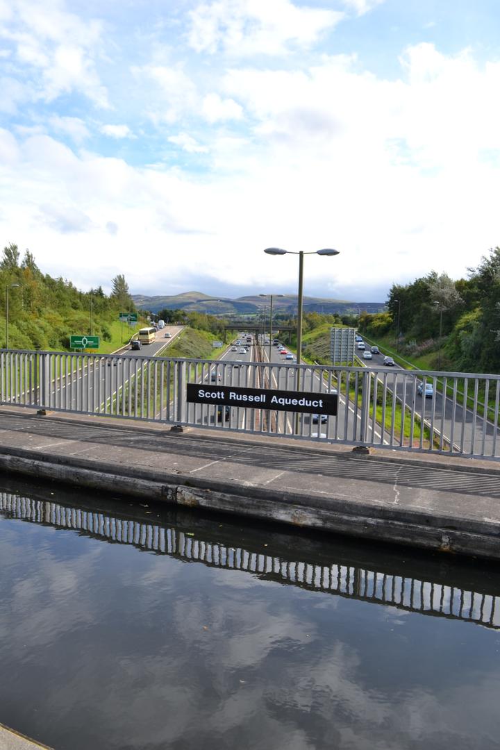
Scott Russell Aqueduct with the Edinburgh Bypass below